July 23, 2005
Beloit Geotags
Is this cool or what?!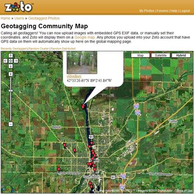
That's the new Hybird view of Google Maps - it lays map data (streets and borders) on top of the satelite image in a live scrolling window view. Those red balloons represent Geotagged photos I've uploaded for sharing on Zoto.com. Click and have a look... should be painless, and pop-up, and garbage-free.
TIP: Double-click an untagged spot on the map to center it, then zoom the view using the slider controls to the left.
Comments:
Post a Comment
<< Home

<< Home
![]()